 |
| Kootenay Valley Outlook |
 |
| Sinclair Canyon |
I reached Kootenay National Park at 2 PM. The entrance park starts at in a city call Radium Hot Springs. There is a fee costing $9.80 in Canadian dollars. It was only a day pass for all the Canadian Rockies Mountains parks. This includes Kootenay, Banff, Jasper and Yoho since the borders of each park are against each other. Mount Robson, Mount Assiniboine and Hamber provincial parks are also located in the system. The combined parks have been declared a UNESCO site. I spent two days in the area exploring Kootenay, Banff, Jasper and Mount Robson parks.
The road I will be traveling is call Banff-Windermere Highway (Hwy 93 south). The road ends at Castle Junction where it meets the Bow Valley Parkway (Hwy 1A). Once you pass the park entrance you enter a narrow passage called Sinclair Canyon. This canyon was original to narrow for wagons and the first owner of the hot spring used dynamite to enlarge the opening for wagons and tourist easy access to the springs. Settlers Road was the main route used to enter Kootenay Valley before Sinclair Canyon was widened. The road still can be traveled today but it is not paved.
 |
| Lake Cobb Trail Parking Lot heading toward Kootenay Valley Outlook |
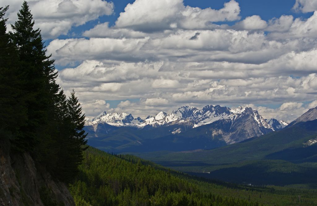 |
| Kootenay Valley with Mitchell Range Mountains |
 |
| Kootenay River Picnic Area |
 |
| Another view of the Kootenay River |
 |
| Entrance to Dolly Varden Picnic Area |
 |
| Hector Gorge |
 |
| The view from Sir George Simpson Marker |
 |
| Numa Falls |
 |
| Numa Falls |
 |
| Numa Falls |
 |
| Numa Falls |
The last stop I made before leaving the park was at Stanley Glacier parking lot to photograph more mountains.
 |
| Stanley Glacier Trail Parking Lot |
Note the post will not let me put any picture in it. I will finish this in Canadian Rockies: Kootenay National Park II.
No comments:
Post a Comment