Wednesday, October 31, 2012

Traveling "Going-to-the Sun Road" Part 3

Cannon Mountain left and Heavens Peak behind the pine.  This was taken from the blind lookout.
The road on the west side of Logan Pass was under construction between Big Bend to Haystack Creek and Logan Creek to Avalanche Creek.  The lookouts that were not under construction were filled with construction equipment so there were not many safe areas to stop and take pictures.

Oberlin Mountain from Loop Lookout.
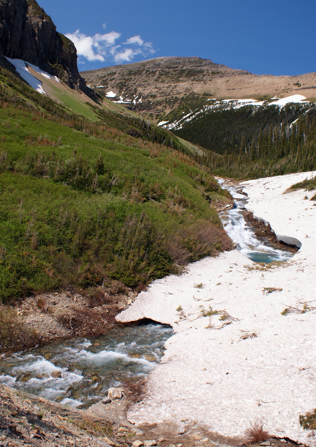
Blind Lookout: Oberlin Mountain with Bird Woman Falls.


Livingston Range from the blind lookout.
I did find a cutout on the mountain side to stop and got some great pictures of Oberlin Mountain, Heavens Peak, Cannon Mountain and a panoramic shot of Livingston Mountain Range.  The cutout was located on a bend that made it tricky to get back on the road since you are blind to traffic coming in both directions.  While I was taking pictures a camper pulled over and almost got hit pulling out.  A construction vehicle was slowly navigating through the blind turn and the camper driver could not see it.  I kept yelling "STOP!" but the camper kept inching forward a little each time.  You should have seen the surprise on his face when he finally saw the trunk and his wife mouthed "Thank You" to me before departing.

The mapped routes before choosing the finally "Going-to-the-Sun Road".
I missed taking pictures at Oberlin Bend, Big Bend, Weeping Wall and the West Tunnel.  The west tunnel has ached openings with wonderful view of the valley below.  The Loop Lookout is the only switchback engineered to traverse through the mountains.  There were several routes mapped to Logan Pass before choosing this one.  One route required 15 switchbacks before reaching Logan Pass.  I did get some nice shots of Oberlin Mountain and Heavens Peck.

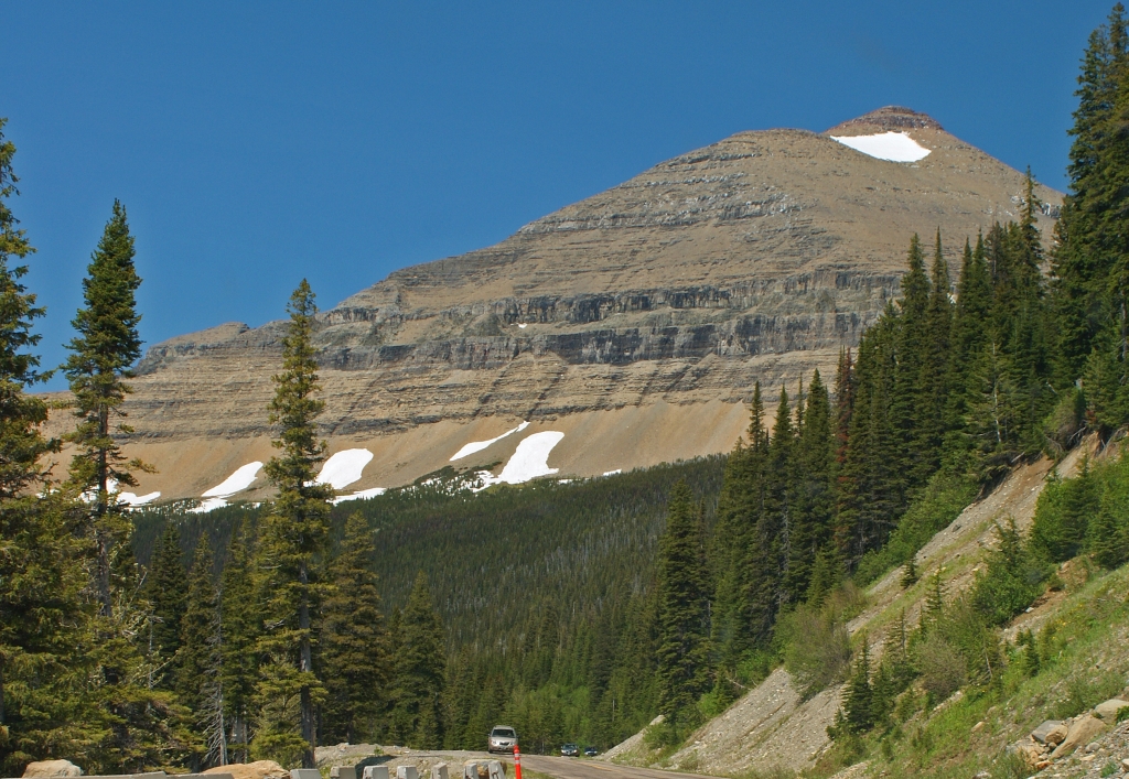
Heavens Peak from the Loop Lookout.
  In 2003 there were masses fires in Glacier and you can see how the land is recovering from it.

A burned area above the Loop.  Later in the summer this area is filled with blooming fireweed.
The next stop was Logan Creek where I photographed an abandon Park Ranger's Cabin before entering the second construction zone from Logan Creek to Avalanche Creek.

Old ranger's cabin on Logan Creek.  Oberlin Mountain is towering in the center with Bird Woman Fall below it.
Stanton Mountain Front Center and Mount Vaught
center rear framed with leaves.
Stanton Mountain Front Center and Mount Vaught
center rear framed with birch trees.


The turnouts were filled with cars and it was getting late so I skipped Avalanche Creek and McDonald Creek Lookouts. I found a turnout along McDonald Lake to stop and enjoyed the beautiful lake along with some great shots of a mountain framed in the trees.

McDonald Lake: Mount Vaught left behind the pine.  Cannon Mountain right peak and Mount Brown is left of Cannon.
The mountains in the background I seen referred to as the highline.
McDonald Lake with the Apgar Mountains in the background.
I drove through Apgar parking lot looking to see if I could find a quick place to stop and take more pictures before leaving.  No such luck and left the park around 6 PM and follow US 2 to Columbia Falls where I turned on Hwy 40. Hwy 40 meets up with US 93 turning north I started looking for a campsite to spent the night. I found Tully National Forest Campground on the map just 4 miles north of Whitefish. This campground is located in Flathead National Forest. Tally Lake is the deepest lake in Montana. The site was clean but it could use an upgrade compare to the Tie Hooks and other sites I been to in Michigan and Northern Wisconsin. The evening ended hearing loud bangs from the Whitefish's fireworks.

My campsite for the night.
The next day would be a long one since I crossed into Canada to visit Canada's premiere Rocky Mountain Nation Park System.

Friday, October 26, 2012

Traveling "Going-to-the-Sun Road" Part 2 Sunrift Gorge to Logan Pass

Jackson Moutain, the glacier on the left side of the snowy peak and is not showing.
Sunrift Gorge was fun to explore but it was time to get in the car and travel to Jackson Glacier scenic turnout.  All the glaciers in the park will be gone by 2020 due to the environmental warming trends.  The park will still be beautiful but the glaciers are a very important geological and environmental force that shaped this national park.  If you want to see glaciers make plans to spend your vacation in this park next year.
Jackson Glacier
Siyeh Bend was fun watching the cars and the park's famous Red Buses driving to and from Logan Pass.  If you do not want to drive on a narrow twisting road taking a Red Bus tour would be a fun way to see the park.  I believe the Red Bus Tours only stops at Logan Pass, the park's does have free shuttle service with many stops along the road where you can get off and explore before continuing on your journey.  
One of the famous Red Bus passing through Siyeh Bend.
Looking up from the Siyeh Bend
you can see Cataract Mountain.


A view of Siyeh Mountain before the bend.

 The June 19th was the first day you could drive from through from the west or the east to the other side.  The road was only open for 16 days before I made the trip and there was still snow along the road near the bend.  The latest the road has opened was July 13, 2011 due to several late winter and early spring storms.
Leaving Siyeh Bend and heading toward Logan Pass.

This picture was taken from an outlook at the top of Siyeh Bend, you can see it in the picture above.
The mountain left of center is Reynolds Mountain and Clements Mountain picture on the upper right edge.
East Tunnel
I made two more stops between Siyeh Bend and Logan Pass.  The mountains just loomed above the road and there is a tunnel going under Piegan Mountain.  Just before I reached Logan Pass I passed through an area called the Big Drift.  The snow falls along the pass can cause drifts to be 90 feet deep along here. The drifts were approximately 20 feet deep for me to see.    Unfortunately there was nowhere to stop and take pictures.  Since I was traveling alone, there was no way I was going to try drive and take pictures on this narrow twisty road.  If you are interest on how the park clears the snow you can find it on the Glacier Park Web site.


This shot was taken at the same outlook as the east
tunnel picture.  Reynolds Mountain looms
above the scenic valley.

A closeup of the falls at the bottom
of the picture on the left.


Logan Pass was completely covered under snow except where the park dug out the parking lot and walkway around the Visitors Center.  The Visitors Center has a nice display about an alpine ecosystem.  The center does not have food available here but there were signs asking people to makes sure they did not leave food items they bring in the parking lot.  The food waste has been attracting the bighorn sheep and making them aggressive.  I did not see any wildlife in the park but I was driving midday and animals are most active early morning and late evening. 
Clements Mountain from the Logan Pass.  The black dots are people hiking to Hidden Lake Lookout.
Both Hidden Lake and Highline Trails were covered with snow.  Only Hidden Lake Trail was open but it was very slippery.  I did try to take some pictures at the beginning of the trail but without a pair of ice cleats I decided to forgo the trip.  Take a close look at Clements Mountain picture and you see tiny black dots.  Those dots are people hiking to the overlook.
Reynolds Mountain, Logan Pass
Logan Pass is the highest point on the "Going-to-the Sun Road".  It is recommended to reach the Pass before noon since the lot fills up quickly.  I was lucky there were a few places open to park when I reach it.  There are times when the park service ropes off the parking lot so the earlier you reach Logan Pass the better your change to Glacier's mountains and alpine ecosystem.
Facing east on the pass you can see Going-to-the-Sun Mountain on the left edge.
Heavy Runner Mountain is on he right edge.
I leave Logan Pass still traveling west and the elevation keeps dropping down to Lake McDonald but this is for the next post.

Monday, October 22, 2012

Traveling "Going-to-the-Sun Road" Part 1


Singleshot Mountain hovering over Two Dog Flats
 After leaving the Visitor Center I stop to take pictures of Two Dog Flats.  The fields later in the summer are filled with prairie wild flowers. 
Indian Blanket (Gaillardia) in Rising Sun Parking Lot
It was now near 1 PM and I need to stop at Rising Sun to eat lunch. I was hoping to find a place protected from the wind and make my own lunch. The cool weather and wind changed my mind and I dined at Two Dog Flats Grill. The food was good but pricey and I have a great view of St Mary Lake. When you dine inside a national park I guess you should expect to pay extra for the ambiance and limited seating.  Lastly I checked out the gift shop and found some great old fashion postcards.

This looms over Rising Sun Motel.  Can anyone tell me if this is Goat Mountain?
Rising Sun is where the mountains begin and you keep climbing up in elevation until you reach Logan Pass. Once I left Rising Sun I spent my time stopping at each pullout and exploring it.  The guild books state it should take 2 hours to drive the road but do not believe it unless you plan to drive straight through.  I spend 6 hours driving it and I did not stop to walk any of the trails leading to the back country.  All my time was spent stopping at each turnout and maybe walking a few 100 yards off the road.  I joked that driving time is dependent on how many pictures you take at the end of the day I took 230.  I also needed to keep moving since I was expected to be in Alaska in 7 to 10 days from the start of the trip.
 
Wild Goose Island Lookout, see Notes for mountains names.
 The Golden Staircase and Wild Goose Island are the next two stops I took pictures of St Mary Lake at each.  Wild Goose Island is the most photographed stop on the road and the picture states it all.

Indian Paint Flowers

Alberta Penstemon
 Here are some of the flower you can see along the way.


Indian Paint and Alberta Penstemon Flowers
I must of skip Sun Point the parking area must have been full when I pass so I continue on to Sunrift Gorge.  Baring Creek formed Sunrift Gorge. 

 
Baring Creek falls

Next falls upstream from previous picture.


Sunrift Gorge

Baring Creek downstream from the gorge and falls.

Sunrift Gorge is about halfway to Logan Pass and the next post will be from Sunrift Gorge to Logan Pass.
Notes: It was easier to label the mountain than explain it in a cation.  Sorry I made 3 change on the mountain identification I keep find more information.  The last change came from Glacier National Park Facebook site.


Sunday, October 21, 2012

Heading to Glacier National Park


Cattle along Sun River.
I left the Buckhouse Inn early and following US 287. The day was sunny and clear and the forest fires’ smoke did not yet reach this far north. Driving along the highway there was no mistaken that you are in cattle country. Everywhere you look there are cattle grazing far and wide and if you looked to the west the Rocky Mountain were looming in the distance.

Sun River from Hwy 287
US 287 ends in the town of Choteau, here I turned of US 89 and followed it up to St Mary just outside the Glacier NP. Choteau was busy preparing for their 4th of July Parade. People around the area were coming for an old fashion parade. The sidewalks were beginning to be lined with lawn chairs. It looked like this town knows how to celebrate our country’s birth. I did not stop long here except to gas up since I wanted to celebrate my 4th of July driving the “Going-to-the-Sun Road”.

Hwy 89 Mile marker 51 near Egg Mountain Historical Marker
Highway 89 climbs up and down the Rocky Mountains foothills; this allows wonderful views of Montana’s vast landscape. The Glacier eastern park edge is surrounded by the Blackfoot Indian Reservation. They marked the beginning of their land with this monument.

Blackfeet Monument sited at the entrance to Blackfeet Indian Reservation.
An hour later I drove into St. Mary stopping to get ice before entering the park. I stop at St. Mary Visitor Center at 11:30 to change out of shorts. The mountain weather is much cooler. Everyone was layering their clothing and cover themselves with a windbreak to keep out the cold wind. The weather forecast stated that the wind was to stop blowing today. The winds were so strong that driving along the I90 corridor my wrists and shoulder ached toward the end of the day. The winds finally ceased blowing when I started climbing up into the Rockies.

St. Mary Lake viewed from Hwy 89 before the town of St. Mary.
I took some time to explore the area around the visitor center and I had fun experimenting with camera shots before going over the "Going-to-the-Sun Road".

St. Mary River near Visitor Center. Red Eagle Mountain is on the left. Right of the far tree is Mahtotopa Mountain and behind it is Little Chief Mountain.
Note: Between getting the house ready for winter and doing research on Glacier National Park it is taking me a long time to put together a new posting. I never knew how hard it would be to identified mountains from pictures. A lot pictures show just the peak and not the whole mountain. Some mountains have more than one peak and I cannot tell if the peak is the mountain or it includes more. So if I have made mistakes please forgive and let me know so I can correct it. Thanks!

Monday, October 8, 2012

Stuffed Green Peppers


My mother would make this old family favorite every autumn.  Each autumn when the weather starts cooling down I start craving for this dish.  This recipe was develop from  Hungarian Stuffed Cabbage Rolls and it is still very good using cabbage leave instead of green peppers.  Be sure to parboil 8 to 10 outer cabbage leaves if you prefer cabbage to green peppers. 

My grandmother on my Mom's side migrated from Hungary and I believe this recipe came from that side of the family. 

I served the stuffed peppers with the sauce over rice.  The two side dishes are baked Delicata winter squash and steamed green beans from my garden.

Enjoy!

Stuffed Green Peppers

Ingredients

8 to 10 medium green peppers, approximately 1 to 1½-inch diameter

Meat Mixture:
1/3 cup uncooked brown rice
1 pound ground beef 
½ teaspoon salt
¼ teaspoon thyme
a dash or two of pepper
1 large chopped onion
1 beaten egg

Sauce:
1 quart whole or chopped tomatoes
 3 tablespoon meat paste or powder
1 tablespoon olive oil
1 chopped onion
2 tablespoon chopped parsley
1/8 teaspoon salt
1½ tablespoon corn starch
       mixed with water

Put 1/3 cup rice with 2/3 cup water and bring to a boil then cover turn down to a simmer until rice adsorbs all the liquid.  While the rice is cooking, cut the green peppers' tops off and clean out the seeds.  Set the pepper aside. 

Once the rice is finished cooking add the rice to the meat mixture.  Thoroughly mixture the ingredients together.  Pack the meat mixture into the green pepper cavities round off at the opening.

Add olive oil to a Dutch Oven; add onions and cook until golden.  Blend half the tomatoes.  Add the blended and whole/chopped tomatoes to the onion.  Add meat paste/powder, salt and parsley.  Bring to a simmer and add the stuffed peppers.  Cover the Dutch oven and simmer for one hour.  Turn green pepper occasionally while simmering.   Blend corn starch with water and add to thicken sauce.

Serve stuffed pepper with sauce over rice.

Makes 8 to 10 servings.
 
Hint: I used Penzey Spices Beef Soup base and seasoning for the meat paste.  It made a very rich tomato sauce.