 |
| Jackson Moutain, the glacier on the left side of the snowy peak and is not showing. |
Sunrift Gorge was fun to explore but it was time to get in the car and travel to Jackson Glacier scenic turnout. All the glaciers in the park will be gone by 2020 due to the environmental warming trends. The park will still be beautiful but the glaciers are a very important geological and environmental force that shaped this national park. If you want to see glaciers make plans to spend your vacation in this park next year.
 |
Jackson Glacier
|
Siyeh Bend was fun watching the cars and the park's famous Red Buses driving to and from Logan Pass. If you do not want to drive on a narrow twisting road taking a Red Bus tour would be a fun way to see the park. I believe the Red Bus Tours only stops at Logan Pass, the park's does have free shuttle service with many stops along the road where you can get off and explore before continuing on your journey.
 |
| One of the famous Red Bus passing through Siyeh Bend. |
 |
| Looking up from the Siyeh Bend you can see Cataract Mountain. |
 |
| A view of Siyeh Mountain before the bend. |
The June 19th was the first day you could drive from through from the west or the east to the other side. The road was only open for 16 days before I made the trip and there was still snow along the road near the bend. The latest the road has opened was July 13, 2011 due to several late winter and early spring storms.
 |
| Leaving Siyeh Bend and heading toward Logan Pass. |
 |
| This picture was taken from an outlook at the top of Siyeh Bend, you can see it in the picture above. The mountain left of center is Reynolds Mountain and Clements Mountain picture on the upper right edge. |
 |
| East Tunnel |
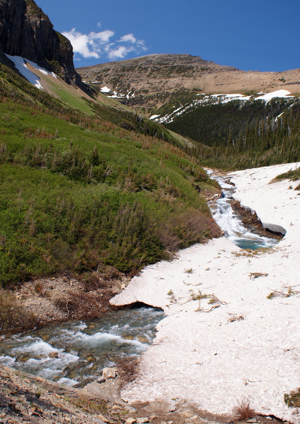
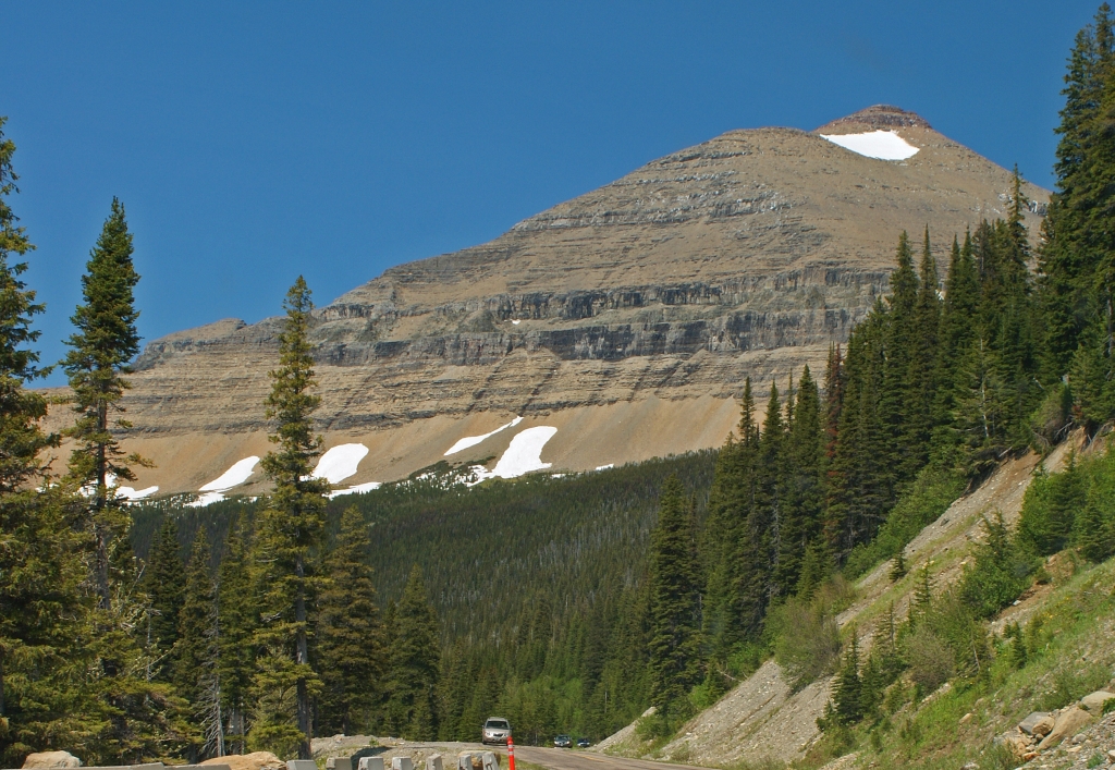
I made two more stops between Siyeh Bend and Logan Pass. The mountains just loomed above the road and there is a tunnel going under Piegan Mountain. Just before I reached Logan Pass I passed through an area called the Big Drift. The snow falls along the pass can cause drifts to be 90 feet deep along here. The drifts were approximately 20 feet deep for me to see. Unfortunately there was nowhere to stop and take pictures. Since I was traveling alone, there was no way I was going to try drive and take pictures on this narrow twisty road. If you are interest on how the park clears the snow you can find it on the Glacier Park Web site.
 |
| This shot was taken at the same outlook as the east tunnel picture. Reynolds Mountain looms above the scenic valley. |
 |
| A closeup of the falls at the bottom of the picture on the left. |
Logan Pass was completely covered under snow except where the park dug out the parking lot and walkway around the Visitors Center. The Visitors Center has a nice display about an alpine ecosystem. The center does not have food available here but there were signs asking people to makes sure they did not leave food items they bring in the parking lot. The food waste has been attracting the bighorn sheep and making them aggressive. I did not see any wildlife in the park but I was driving midday and animals are most active early morning and late evening.
 |
| Clements Mountain from the Logan Pass. The black dots are people hiking to Hidden Lake Lookout. |
Both Hidden Lake and Highline Trails were covered with snow. Only Hidden Lake Trail was open but it was very slippery. I did try to take some pictures at the beginning of the trail but without a pair of ice cleats I decided to forgo the trip. Take a close look at Clements Mountain picture and you see tiny black dots. Those dots are people hiking to the overlook.
 |
| Reynolds Mountain, Logan Pass |
Logan Pass is the highest point on the "Going-to-the Sun Road". It is recommended to reach the Pass before noon since the lot fills up quickly. I was lucky there were a few places open to park when I reach it. There are times when the park service ropes off the parking lot so the earlier you reach Logan Pass the better your change to Glacier's mountains and alpine ecosystem.
 |
| Facing east on the pass you can see Going-to-the-Sun Mountain on the left edge.
Heavy Runner Mountain is on he right edge.
|
I leave Logan Pass still traveling west and the elevation keeps dropping down to Lake McDonald but this is for the next post.
No comments:
Post a Comment